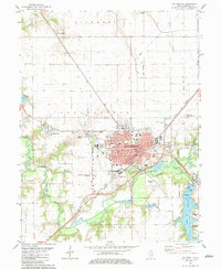
1982 Map of Taylorville
USGS Topo · Published 1983About this map
The Taylorville street grid and surrounding Christian County farm country define this 1982 landscape, where the confluence of the Sangamon River and its South Fork shapes the local topography. The map illustrates a dense concentration of civic infrastructure, from the City Hall and Post Office to the Memorial Hospital and multiple local schools like North School and South School. The presence of the County Fairground and Manners Park underscores the town's role as a regional hub.
Find a feature on this map
54 named features on this map. Tap any name to fly to it.
Don’t see what you’re looking for? This feature index may not catch every label — zoom into the map to look around manually.
Map Details
Editions of this 1982 Taylorville Map
This is the sole edition of this map. No revisions or reprints were ever made.
Other maps of this area

1923 · Taylorville
USGS Topo · 1:62,500

1925 · Taylorville
USGS Topo · 1:62,500

1946 · Nokomis
USGS Topo · 1:62,500

1947 · Pana
USGS Topo · 1:62,500

1949 · Nokomis
USGS Topo · 1:62,500

1949 · Pana
USGS Topo · 1:62,500

1952 · Assumption
USGS Topo · 1:62,500

1958 · Decatur
USGS Topo · 1:250,000

1961 · Decatur
USGS Topo · 1:250,000

1974 · Willeys
USGS Topo · 1:24,000