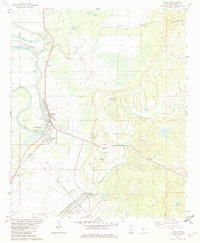
1982 Map of Tchula
USGS Topo · Published 1982About this map
Tchula and its surrounding delta landscape are defined by the winding waters of Tchula Lake and the Illinois Central Gulf railroad line. The settlement pattern follows the fertile ground between the Morgan Brake and the extensive Hillside National Wildlife Refuge to the south. The map documents numerous community landmarks, from the Tchula Attendance Center to a high density of rural spiritual centers including Rose Hill Ch, Bethlehem Ch, and Mt Zion Ch.
Find a feature on this map
45 named features on this map. Tap any name to fly to it.
Don’t see what you’re looking for? This feature index may not catch every label — zoom into the map to look around manually.
Map Details
Editions of this 1982 Tchula Map
This is the sole edition of this map. No revisions or reprints were ever made.
Other maps of this area

1940 · Seven Pines
USGS Topo · 1:62,500

1940 · Lexington
USGS Topo · 1:62,500

1940 · Mileston
USGS Topo · 1:62,500

1953 · Greenwood
USGS Topo · 1:250,000

1954 · Mileston
USGS Topo · 1:62,500

1956 · Greenwood
USGS Topo · 1:250,000

1957 · Lexington
USGS Topo · 1:62,500

1957 · Seven Pines
USGS Topo · 1:62,500

1958 · Seven Pines
USGS Topo · 1:62,500

1958 · Lexington
USGS Topo · 1:62,500