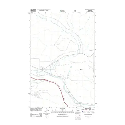
2011 Map of Teanaway
USGS Topo · Published 2011About this map
The Teanaway River converges with the Yakima River in this central Washington corridor, where water management and transportation routes define the landscape. Small settlements and sidings like Teanaway, Bristol, and Horlick follow the valley floor, interspersed with agricultural infrastructure such as the Main Canal. The terrain transitions from the flat expanse of Bristol Flat to prominent elevations like Lookout Mountain and Indian John Hill.
Find a feature on this map
42 named features on this map. Tap any name to fly to it.
Don’t see what you’re looking for? This feature index may not catch every label — zoom into the map to look around manually.
Map Details
Editions of this 2011 Teanaway Map
This is the sole edition of this map. No revisions or reprints were ever made.
Other maps of this area

1897 · Mount Stuart
USGS Topo · 1:125,000

1902 · Mount Stuart
USGS Topo · 1:125,000

1957 · Wenatchee
USGS Topo · 1:250,000

1958 · Thorp
USGS Topo · 1:24,000

1958 · Thorp
USGS Topo · 1:62,500

1958 · Cle Elum
USGS Topo · 1:62,500

1961 · Liberty
USGS Topo · 1:62,500

1961 · Mount Stuart
USGS Topo · 1:62,500

1975 · Wenatchee
USGS Topo · 1:100,000
1984 · Cle Elum
USGS Topo · 1:24,000