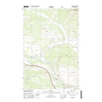
2017 Map of Teanaway
USGS Topo · Published 2017About this map
The Teanaway River converges with the Yakima River in this central Kittitas County landscape, where agricultural valleys meet the rising slopes of Cle Elum Ridge. The settlement patterns here are defined by the water and terrain, with the small communities of Teanaway, Bristol, and Horlick following the river corridor. Land use is a mix of irrigation and forestry, evidenced by the Main Canal winding through the southern hills and the northern boundary of the Wenatchee National Forest.
Find a feature on this map
59 named features on this map. Tap any name to fly to it.
Don’t see what you’re looking for? This feature index may not catch every label — zoom into the map to look around manually.
Map Details
Editions of this 2017 Teanaway Map
This is the sole edition of this map. No revisions or reprints were ever made.
Other maps of this area

1897 · Mount Stuart
USGS Topo · 1:125,000

1902 · Mount Stuart
USGS Topo · 1:125,000

1957 · Wenatchee
USGS Topo · 1:250,000

1958 · Thorp
USGS Topo · 1:24,000

1958 · Thorp
USGS Topo · 1:62,500

1958 · Cle Elum
USGS Topo · 1:62,500

1961 · Liberty
USGS Topo · 1:62,500

1961 · Mount Stuart
USGS Topo · 1:62,500

1975 · Wenatchee
USGS Topo · 1:100,000
1984 · Cle Elum
USGS Topo · 1:24,000