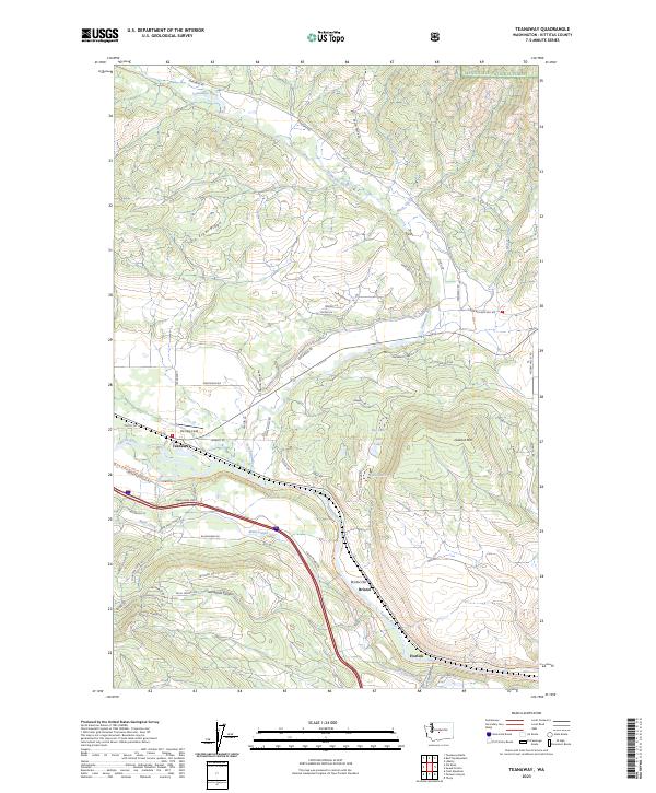
2023 Map of Teanaway
USGS Topo · Published 2023About this map
Teanaway River and Yakima River define the lower elevations of this Kittitas County landscape, where the settlements of Teanaway, Bristol, and Horlick sit along established transport corridors. The southern half of the sheet is dominated by the Main Canal, which cuts across the terrain near Bristol Flat, supporting the local agricultural infrastructure. Significant elevation changes are marked by Cle Elum Ridge and Lookout Mtn, while the northern reaches enter the protected timberlands of the Wenatchee National Forest.
Find a feature on this map
63 named features on this map. Tap any name to fly to it.
Don’t see what you’re looking for? This feature index may not catch every label — zoom into the map to look around manually.
Map Details
Editions of this 2023 Teanaway Map
This is the sole edition of this map. No revisions or reprints were ever made.
Other maps of this area

1897 · Mount Stuart
USGS Topo · 1:125,000

1902 · Mount Stuart
USGS Topo · 1:125,000

1957 · Wenatchee
USGS Topo · 1:250,000

1958 · Thorp
USGS Topo · 1:24,000

1958 · Thorp
USGS Topo · 1:62,500

1958 · Cle Elum
USGS Topo · 1:62,500

1961 · Liberty
USGS Topo · 1:62,500

1961 · Mount Stuart
USGS Topo · 1:62,500

1975 · Wenatchee
USGS Topo · 1:100,000
1984 · Cle Elum
USGS Topo · 1:24,000