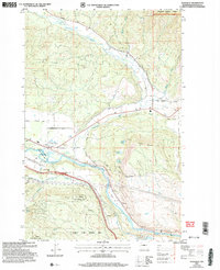
2003 Map of Teanaway
USGS Topo · Published 2006About this map
Yakima River and Teanaway River define the hydraulic landscape of this Kittitas County region, where the high slopes of Cle Elum Ridge and Wenatchee National Forest descend into a complex network of agricultural and wildlife management lands. The presence of The Main Canal tracing the southern valley floor indicates the intensive water management required to support the local economy near settlements like Bristol and Lambert. In the southwest, the L T Murray State Wildlife Area encompasses landmarks such as Indian John Hill, showcasing the preservation of open space alongside utility features like the Communication Facility on Lookout Mountain. Historical land use is further evidenced by a variety of transport routes, from the winding Teanaway Road to the localized Airport Road and De Vere Field, which serves the small community of Teanaway.
Find a feature on this map
38 named features on this map. Tap any name to fly to it.
Don’t see what you’re looking for? This feature index may not catch every label — zoom into the map to look around manually.
Map Details
Editions of this 2003 Teanaway Map
This is the sole edition of this map. No revisions or reprints were ever made.
Other maps of this area

1897 · Mount Stuart
USGS Topo · 1:125,000

1902 · Mount Stuart
USGS Topo · 1:125,000

1957 · Wenatchee
USGS Topo · 1:250,000

1958 · Thorp
USGS Topo · 1:24,000

1958 · Thorp
USGS Topo · 1:62,500

1958 · Cle Elum
USGS Topo · 1:62,500

1961 · Liberty
USGS Topo · 1:62,500

1961 · Mount Stuart
USGS Topo · 1:62,500

1975 · Wenatchee
USGS Topo · 1:100,000
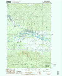
1984 · Cle Elum
USGS Topo · 1:24,000