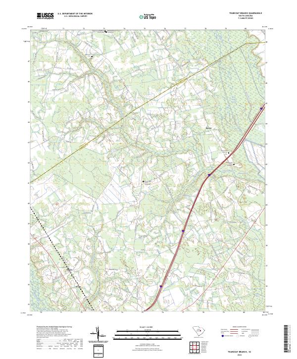
2024 Map of Tearcoat Branch
USGS Topo · Published 2024About this map
The Pocotaligo River and its various tributaries define the low-lying landscape of this Clarendon County region, where the town of Alcolu stands as a primary settlement. Historically a hub of local transport and commerce, the area is characterized by a dense network of country roads such as Plowden Mill Rd and Tearcoat Rd that connect rural clusters like Harvin and Durant. Significant genealogical interest is found in the distribution of several community burial sites, including the Congruity Presbyterian Church Cem, the Westminster Church Graveyard, and the private Ruby M B Simon Family Cem. The terrain transitions from cultivated land and residential developments like Pinecrest Acres into the expansive Black River Swamp, reflecting the hydraulic patterns of the Tearcoat Branch and its surrounding wetlands.
Find a feature on this map
90 named features on this map. Tap any name to fly to it.
Don’t see what you’re looking for? This feature index may not catch every label — zoom into the map to look around manually.
Map Details
Editions of this 2024 Tearcoat Branch Map
This is the sole edition of this map. No revisions or reprints were ever made.
Other maps of this area

1920 · Mayesville
USGS Topo · 1:48,000

1920 · Manning
USGS Topo · 1:48,000

1921 · Manning
USGS Topo · 1:62,500

1921 · Mayesville
USGS Topo · 1:62,500

1943 · Mayesville
USGS Topo · 1:62,500

1944 · Manning
USGS Topo · 1:62,500

1946 · Sumter
USGS Topo · 1:62,500

1954 · Augusta
USGS Topo · 1:250,000

1957 · Sumter East
USGS Topo · 1:24,000

1957 · Sumter
USGS Topo · 1:62,500