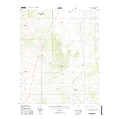
2017 Map of Tecolote Peak
USGS Topo · Published 2017About this map
Tecolote Peak and the high desert terrain of Lincoln County dominate this high-altitude landscape within the Cibola National Forest. The settlement of Tecolote is positioned along Co Rd A032 in the southern portion of the quadrangle, serving as a focal point for the surrounding cattle country. The landscape is characterized by a sophisticated network of water infrastructure essential for ranching in this arid environment, evidenced by named features like Roosevelt Tank, Martin Tank, and Abe Tank. High ground like ET Mesa and the drainage of South Canyon define the area's topography, while the Lincoln Station Airport provides a modern transportation link to this remote stretch of New Mexico. This survey captures the intersection of traditional land use and public forest management during the early 21st century.
Find a feature on this map
20 named features on this map. Tap any name to fly to it.
Don’t see what you’re looking for? This feature index may not catch every label — zoom into the map to look around manually.
Map Details
Editions of this 2017 Tecolote Peak Map
This is the sole edition of this map. No revisions or reprints were ever made.
Other maps of this area

1950 · Little Black Peak
USGS Topo · 1:62,500

1954 · Fort Sumner
USGS Topo · 1:250,000

1955 · Roswell
USGS Topo · 1:250,000

1958 · Fort Sumner
USGS Topo · 1:250,000

1958 · Roswell
USGS Topo · 1:250,000

1962 · Roswell
USGS Topo · 1:250,000

1973 · Ancho
USGS Topo · 1:24,000

1973 · Chupadero Mountain
USGS Topo · 1:24,000

1980 · Corona
USGS Topo · 1:100,000

1981 · Rough Mountain
USGS Topo · 1:24,000