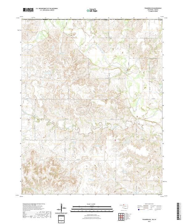
2022 Map of Tegarden NE
USGS Topo · Published 2022About this map
The Salt Fork Arkansas River carves through this portion of Woods Co near the Kansas border, defining a landscape of drainage networks and prairie water management. This 2022 survey documents an extensive system of rural roads and water resources, including the Isenbart Number 1 Reservoir and the Thurman Reservoir. The terrain is marked by named drainage features such as Yellowstone Cr and Hackberry Cr which feed into the primary river system. Historical water sources like Buffalo Spring remain documented alongside modern infrastructure, illustrating the long-term reliance on reliable water in this northern Oklahoma plains environment. Large section-line roads like Major Rd and Logan Rd establish the geometric grid typical of the region's agricultural development.
Find a feature on this map
40 named features on this map. Tap any name to fly to it.
Don’t see what you’re looking for? This feature index may not catch every label — zoom into the map to look around manually.
Map Details
Editions of this 2022 Tegarden NE Map
This is the sole edition of this map. No revisions or reprints were ever made.
Other maps of this area

1891 · Medicine Lodge
USGS Topo · 1:125,000

1893 · Medicine Lodge
USGS Topo · 1:125,000

1955 · Woodward
USGS Topo · 1:250,000

1955 · Pratt
USGS Topo · 1:250,000

1958 · Woodward
USGS Topo · 1:250,000

1959 · Pratt
USGS Topo · 1:250,000

1969 · Tegarden NE
USGS Topo · 1:24,000

1969 · Tegarden SE
USGS Topo · 1:24,000

1969 · Tegarden NW
USGS Topo · 1:24,000

1969 · Alva NW
USGS Topo · 1:24,000