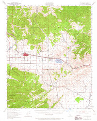
1943 Map of Tehachapi
USGS Topo · Published 1965About this map
Tehachapi Mountains and the southern Sierra Nevada converge on this mid-century survey, centered on the high valley where the Southern Pacific railroad crests the mountains. The town of Tehachapi serves as the hub of this upland landscape, while the industrial operations at Monolith and its adjacent Cement Plant highlight the region's mineral-driven economy. A critical intersection of transport and geography, the map traces the railroad through Summit and down toward Tehachapi Pass, a route established by the challenges of the terrain.
Find a feature on this map
29 named features on this map. Tap any name to fly to it.
Don’t see what you’re looking for? This feature index may not catch every label — zoom into the map to look around manually.
Map Details
Editions of this 1943 Tehachapi Map
4 editions found
Other maps of this area

1903 · Tejon
USGS Topo · 1:125,000

1914 · Caliente
USGS Topo · 1:125,000

1915 · Elizabeth Lake
USGS Topo · 1:125,000

1915 · Mojave
USGS Topo · 1:125,000

1917 · Elizabeth Lake
USGS Topo · 1:125,000

1943 · Rosamond
USGS Topo · 1:62,500

1943 · Tehachapi
USGS Topo · 1:62,500

1943 · Cross Mountain
USGS Topo · 1:62,500

1943 · Emerald Mtn
USGS Topo · 1:62,500

1943 · Cummings Mountain
USGS Topo · 1:62,500