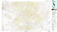
1978 Map of Tehachapi
USGS Topo · Published 1993About this map
Agricultural expansion and mountainous terrain intersect on this late-1970s survey, where the floor of the San Joaquin Valley meets the high ridges of the Tehachapi Mountains. West of the peaks, intensive irrigation is evident around Di Giorgio, Weed Patch, and Arvin, illustrating the industrial scale of California's interior farming. In the north, the Sequoia National Forest covers the steep slopes of the Piute Mountains, while the Kern River flows through the northwest corner toward Bakersfield.
Find a feature on this map
50 named features on this map. Tap any name to fly to it.
Don’t see what you’re looking for? This feature index may not catch every label — zoom into the map to look around manually.
Map Details
Editions of this 1978 Tehachapi Map
This is the sole edition of this map. No revisions or reprints were ever made.
Other maps of this area

1903 · Mt. Pinos
USGS Topo · 1:125,000

1903 · Tejon
USGS Topo · 1:125,000

1906 · Bakersfield
USGS Topo · 1:62,500

1906 · Kernville
USGS Topo · 1:125,000

1908 · Kernville
USGS Topo · 1:125,000

1910 · Buena Vista Lake
USGS Topo · 1:125,000

1912 · Buena Vista Lake
USGS Topo · 1:125,000

1914 · Caliente
USGS Topo · 1:125,000

1915 · Elizabeth Lake
USGS Topo · 1:125,000

1915 · Searles Lake
USGS Topo · 1:250,000