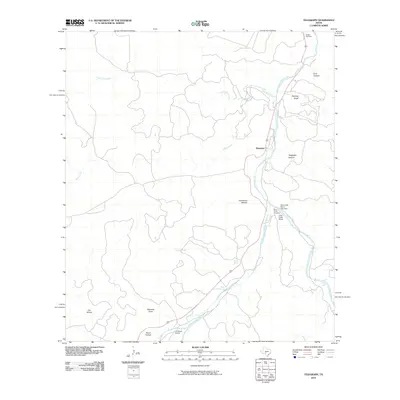
2010 Map of Telegraph
USGS Topo · Published 2010About this map
The South Llano River carves a deep path through this section of the Edwards Plateau, where the small community of Telegraph sits along the winding riverbanks. The landscape is defined by its dramatic relief, with steep-walled drainages such as Telegraph Canyon, Ford Canyon, and Christmas Hollow feeding into the river system. This 2010 topographic record captures a predominantly ranching landscape, highlighted by the extensive Paint Creek Ranch and the private J R Ranch Airport. Local history is anchored by family and community landmarks, including Paint Creek Cemetery and Woaten Cemetery. A notable concentration of water resources is found in the southern reach of the river, where Seven Hundred Springs and Bowie Spring emerge from the limestone, sustaining the flow of Paint Creek and the river downstream.
Find a feature on this map
20 named features on this map. Tap any name to fly to it.
Don’t see what you’re looking for? This feature index may not catch every label — zoom into the map to look around manually.
Map Details
Editions of this 2010 Telegraph Map
This is the sole edition of this map. No revisions or reprints were ever made.
Other maps of this area

1893 · Rock Springs
USGS Topo · 1:125,000

1926 · Segovia 2-c
USGS Topo · 1:48,000

1932 · Junction
USGS Topo · 1:62,500

1954 · Llano
USGS Topo · 1:250,000

1954 · Sonora
USGS Topo · 1:250,000

1955 · Llano
USGS Topo · 1:250,000

1956 · Llano
USGS Topo · 1:250,000

1958 · Sonora
USGS Topo · 1:250,000

1962 · Hill Ranch
USGS Topo · 1:24,000

1962 · Roosevelt
USGS Topo · 1:24,000