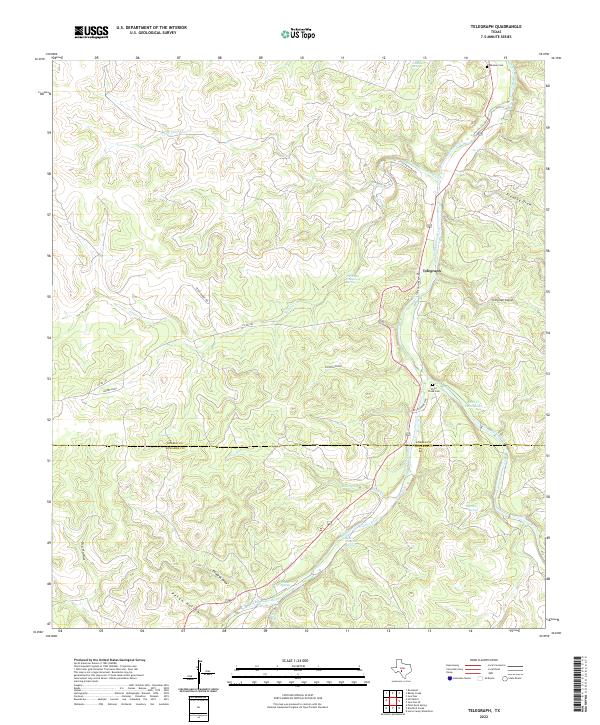
2022 Map of Telegraph
USGS Topo · Published 2022About this map
The Telegraph settlement sits along the South Llano River in this part of the Texas Hill Country where the plateau begins to break into steep draws and hollows. The landscape is defined by the river’s winding course and its numerous tributaries, including Salina Cr and Little Paint Cr. Natural water sources are abundant here, with Seven Hundred Springs and Tanner Springs emerging from the limestone.
Find a feature on this map
31 named features on this map. Tap any name to fly to it.
Don’t see what you’re looking for? This feature index may not catch every label — zoom into the map to look around manually.
Map Details
Editions of this 2022 Telegraph Map
This is the sole edition of this map. No revisions or reprints were ever made.
Other maps of this area

1893 · Rock Springs
USGS Topo · 1:125,000

1926 · Segovia 2-c
USGS Topo · 1:48,000

1932 · Junction
USGS Topo · 1:62,500

1954 · Llano
USGS Topo · 1:250,000

1954 · Sonora
USGS Topo · 1:250,000

1955 · Llano
USGS Topo · 1:250,000

1956 · Llano
USGS Topo · 1:250,000

1958 · Sonora
USGS Topo · 1:250,000

1962 · Hill Ranch
USGS Topo · 1:24,000

1962 · Roosevelt
USGS Topo · 1:24,000