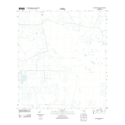
2012 Map of Telegraph Swamp
USGS Topo · Published 2012About this map
Babcock Ranch defines the northern landscape of this Charlotte County area, a sprawling territory where land use transitions between managed ranching and expansive natural wetlands. The presence of the Babcock HQ Airport near the ranch headquarters signifies the logistical requirements of overseeing such a large Florida estate. The topography is dominated by complex water systems, primarily the namesake Telegraph Swamp and the Bullhead Strand, which dictate the local ecology. These wetlands are drained by a network of waterways including Telegraph Cr, Trout Cr, and Clay Gully. In the southern portion of the map, the landscape shows signs of modern infrastructure with the appearance of Argo Dr and drainage features like Stricklin Gully, illustrating the persistent effort to manage water in this low-lying region.
Find a feature on this map
9 named features on this map. Tap any name to fly to it.
Don’t see what you’re looking for? This feature index may not catch every label — zoom into the map to look around manually.
Map Details
Editions of this 2012 Telegraph Swamp Map
This is the sole edition of this map. No revisions or reprints were ever made.
Other maps of this area

1956 · Telegraph Swamp
USGS Topo · 1:24,000

1956 · Telegraph Swamp NE
USGS Topo · 1:24,000

1956 · Telegraph Swamp NW
USGS Topo · 1:24,000

1956 · Bermont
USGS Topo · 1:24,000

1956 · West Palm Beach
USGS Topo · 1:250,000

1957 · West Palm Beach
USGS Topo · 1:250,000

1957 · Tuckers Corner
USGS Topo · 1:24,000

1957 · Telegraph Swamp SE
USGS Topo · 1:24,000

1958 · West Palm Beach
USGS Topo · 1:250,000

1958 · Olga
USGS Topo · 1:24,000