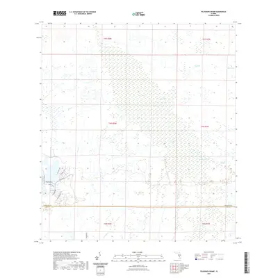
2021 Map of Telegraph Swamp
USGS Topo · Published 2021About this map
Telegraph Swamp and its associated water systems dominate this South Florida landscape near the border of Charlotte and Lee counties. The map documents the intricate network of drainage and natural flow lines that define the region, including Telegraph Creek, Trout Cr, and the slow-moving waters of Bullhead Strand. Unlike the open wetlands to the north, the southwestern corner shows the modern imprint of the Babcock Ranch development, marked by a structured grid of residential infrastructure including Cypress Pkwy and Lake Babcock Dr.
Find a feature on this map
26 named features on this map. Tap any name to fly to it.
Don’t see what you’re looking for? This feature index may not catch every label — zoom into the map to look around manually.
Map Details
Editions of this 2021 Telegraph Swamp Map
This is the sole edition of this map. No revisions or reprints were ever made.
Other maps of this area

1956 · Telegraph Swamp
USGS Topo · 1:24,000

1956 · Telegraph Swamp NE
USGS Topo · 1:24,000

1956 · Telegraph Swamp NW
USGS Topo · 1:24,000

1956 · Bermont
USGS Topo · 1:24,000

1956 · West Palm Beach
USGS Topo · 1:250,000

1957 · West Palm Beach
USGS Topo · 1:250,000

1957 · Tuckers Corner
USGS Topo · 1:24,000

1957 · Telegraph Swamp SE
USGS Topo · 1:24,000

1958 · West Palm Beach
USGS Topo · 1:250,000

1958 · Olga
USGS Topo · 1:24,000