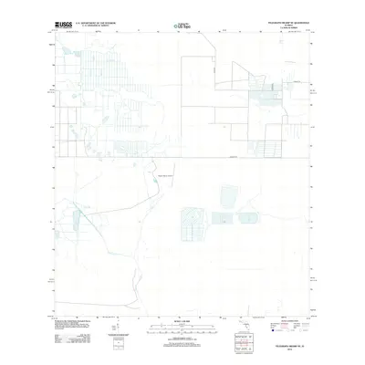
2012 Map of Telegraph Swamp NE
USGS Topo · Published 2012About this map
Payson Ranch Airport serves as a central landmark in this portion of Charlotte County, surrounded by a landscape defined by drainage patterns and rural infrastructure. The natural hydrology is marked by Rainey Slough in the northeast and the meandering course of Jacks Branch (also labeled Jacks Br) to the southwest. This 2012 survey illustrates the geometric precision of local land use, where a network of local thoroughfares like Bermont Rd, Quail Rd, and Farabee Rd provides access to vast tracts of land. The map reveals a structured approach to water management and aviation-based ranch operations characteristic of the Florida interior during this era.
Find a feature on this map
8 named features on this map. Tap any name to fly to it.
Don’t see what you’re looking for? This feature index may not catch every label — zoom into the map to look around manually.
Map Details
Editions of this 2012 Telegraph Swamp NE Map
This is the sole edition of this map. No revisions or reprints were ever made.
Other maps of this area

1956 · Telegraph Swamp
USGS Topo · 1:24,000

1956 · Telegraph Swamp NE
USGS Topo · 1:24,000

1956 · Telegraph Swamp NW
USGS Topo · 1:24,000

1956 · Long Island Marsh SW
USGS Topo · 1:24,000

1956 · West Palm Beach
USGS Topo · 1:250,000

1956 · Fort Pierce
USGS Topo · 1:250,000

1957 · West Palm Beach
USGS Topo · 1:250,000

1957 · Long Island Marsh SE
USGS Topo · 1:24,000

1957 · Venus SW
USGS Topo · 1:24,000

1957 · Telegraph Swamp SE
USGS Topo · 1:24,000