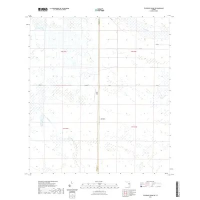
2021 Map of Telegraph Swamp NE
USGS Topo · Published 2021About this map
Rainey Slough and Jacks Branch define the drainage of this interior Florida landscape, where the flatlands of the Gulf Coastal Plain meet the agricultural and ranching interior. Located along the border between Charlotte and Glades counties, the area is characterized by large-scale land management and specialized transport. The presence of Payson Ranch Airport and Lykes Silver Lake Airport points to the reliance on private aviation for managing expansive ranching operations in this part of the state. A grid of local roads, including Bermont Rd and Co Rd 74, provides the primary access through the townships, which are largely dominated by wetlands and open pastures. This survey provides a clear view of the rural infrastructure as it stood in the early twenty-first century, emphasizing the intersection of natural watercourses and human-engineered transport routes.
Find a feature on this map
14 named features on this map. Tap any name to fly to it.
Don’t see what you’re looking for? This feature index may not catch every label — zoom into the map to look around manually.
Map Details
Editions of this 2021 Telegraph Swamp NE Map
This is the sole edition of this map. No revisions or reprints were ever made.
Other maps of this area

1956 · Telegraph Swamp
USGS Topo · 1:24,000

1956 · Telegraph Swamp NE
USGS Topo · 1:24,000

1956 · Telegraph Swamp NW
USGS Topo · 1:24,000

1956 · Long Island Marsh SW
USGS Topo · 1:24,000

1956 · West Palm Beach
USGS Topo · 1:250,000

1956 · Fort Pierce
USGS Topo · 1:250,000

1957 · West Palm Beach
USGS Topo · 1:250,000

1957 · Long Island Marsh SE
USGS Topo · 1:24,000

1957 · Venus SW
USGS Topo · 1:24,000

1957 · Telegraph Swamp SE
USGS Topo · 1:24,000