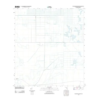
2012 Map of Telegraph Swamp NW
USGS Topo · Published 2012About this map
Fred Babcock Airport anchors the southwestern portion of this 2012 survey, situated in a section of Charlotte County characterized by a rigid grid of drainage canals and property divisions. The landscape reflects a large-scale attempt at land management, with systematic water control channels cutting through the terrain. A sparse network of roads, including Bermont Rd and Graham Rd, provides access across the structured parcels. The presence of Chiquita Dr and Neal Rd in the north indicates localized development patterns within the broader marshy environment, where man-made alterations have reshaped the natural hydrology of the Telegraph Swamp area.
Find a feature on this map
5 named features on this map. Tap any name to fly to it.
Don’t see what you’re looking for? This feature index may not catch every label — zoom into the map to look around manually.
Map Details
Editions of this 2012 Telegraph Swamp NW Map
This is the sole edition of this map. No revisions or reprints were ever made.
Other maps of this area

1956 · Arcadia SE
USGS Topo · 1:24,000

1956 · Telegraph Swamp
USGS Topo · 1:24,000

1956 · Telegraph Swamp NE
USGS Topo · 1:24,000

1956 · Telegraph Swamp NW
USGS Topo · 1:24,000

1956 · Long Island Marsh SW
USGS Topo · 1:24,000

1956 · Bermont
USGS Topo · 1:24,000

1956 · West Palm Beach
USGS Topo · 1:250,000

1956 · Fort Pierce
USGS Topo · 1:250,000

1957 · West Palm Beach
USGS Topo · 1:250,000

1957 · Long Island Marsh SE
USGS Topo · 1:24,000