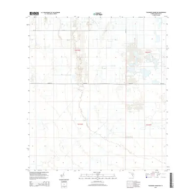
2015 Map of Telegraph Swamp NW
USGS Topo · Published 2015About this map
The low-lying wetlands of Charlotte County are documented here as they appeared in 2015, featuring a grid-like pattern of rural infrastructure and land management. Secondary routes such as Bermont Rd and Neal Rd bisect the landscape, providing the primary access points through this area of Telegraph Swamp. The map showcases the Public Land Survey System (PLSS) divisions, clearly marking townships and ranges including t40s r26e and t40s r27e. This modern survey illustrates the persistent drainage and access patterns required to manage the seasonally wet Florida terrain. The sparse naming of local landmarks underscores the rural, sparsely populated nature of this interior region, where Chiquita Dr serves as one of the few named interior connectors between the major east-west corridors.
Find a feature on this map
7 named features on this map. Tap any name to fly to it.
Don’t see what you’re looking for? This feature index may not catch every label — zoom into the map to look around manually.
Map Details
Editions of this 2015 Telegraph Swamp NW Map
This is the sole edition of this map. No revisions or reprints were ever made.
Other maps of this area

1956 · Arcadia SE
USGS Topo · 1:24,000

1956 · Telegraph Swamp
USGS Topo · 1:24,000

1956 · Telegraph Swamp NE
USGS Topo · 1:24,000

1956 · Telegraph Swamp NW
USGS Topo · 1:24,000

1956 · Long Island Marsh SW
USGS Topo · 1:24,000

1956 · Bermont
USGS Topo · 1:24,000

1956 · West Palm Beach
USGS Topo · 1:250,000

1956 · Fort Pierce
USGS Topo · 1:250,000

1957 · West Palm Beach
USGS Topo · 1:250,000

1957 · Long Island Marsh SE
USGS Topo · 1:24,000