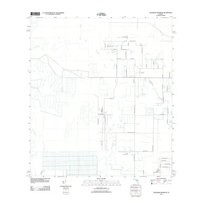
2012 Map of Telegraph Swamp SE
USGS Topo · Published 2012About this map
Jacks Br and its tributaries define the low-lying drainage patterns of this Florida landscape as it appeared in the early 2010s. The region is characterized by a developing grid of rural residential roads and agricultural tracts, notably around Spanish Trl and Kirby Thompson Rd SW. In the northern section, a dense cluster of named lanes like Rattlesnake Rd and Catamount Rd suggests a planned transition from open land to more structured rural living. To the south, the historic Fort Denaud Cem sits near the map's border, anchoring the area's local heritage. Transportation is represented by the South Point Airport, while water features like Jacks Lake, Clay Gully, and the Bullhead Strand illustrate the natural hydrology that still shapes the terrain despite modern development.
Find a feature on this map
56 named features on this map. Tap any name to fly to it.
Don’t see what you’re looking for? This feature index may not catch every label — zoom into the map to look around manually.
Map Details
Editions of this 2012 Telegraph Swamp SE Map
This is the sole edition of this map. No revisions or reprints were ever made.
Other maps of this area

1956 · Telegraph Swamp
USGS Topo · 1:24,000

1956 · Telegraph Swamp NE
USGS Topo · 1:24,000

1956 · Telegraph Swamp NW
USGS Topo · 1:24,000

1956 · West Palm Beach
USGS Topo · 1:250,000

1957 · West Palm Beach
USGS Topo · 1:250,000

1957 · Telegraph Swamp SE
USGS Topo · 1:24,000

1958 · West Palm Beach
USGS Topo · 1:250,000

1958 · La Belle NW
USGS Topo · 1:24,000

1958 · Olga
USGS Topo · 1:24,000

1958 · Alva
USGS Topo · 1:24,000