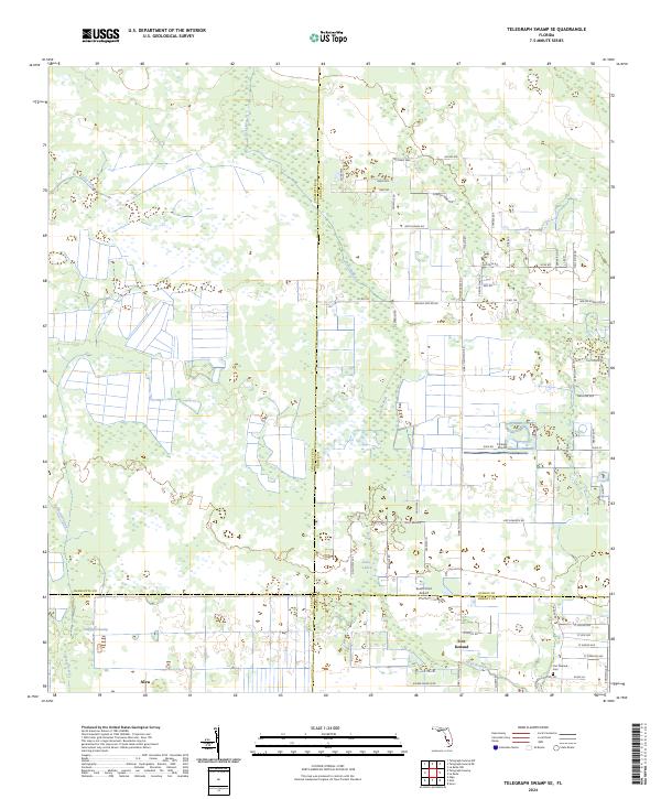
2024 Map of Telegraph Swamp SE
USGS Topo · Published 2024About this map
Fort Denaud and Alva anchor the southern reaches of this landscape, where the agricultural and rural character of Southwest Florida is clearly defined by its complex hydrology. The interior is a web of named wetlands and watercourses, including the extensive Telegraph Swamp and the drainage of Jacks Branch, which feeds into Jacks Lake. These natural features dictate the irregular grid of local roads and the placement of remote airfields like South Point Airport and Flying L Airport.
Find a feature on this map
69 named features on this map. Tap any name to fly to it.
Don’t see what you’re looking for? This feature index may not catch every label — zoom into the map to look around manually.
Map Details
Editions of this 2024 Telegraph Swamp SE Map
This is the sole edition of this map. No revisions or reprints were ever made.
Other maps of this area

1956 · Telegraph Swamp
USGS Topo · 1:24,000

1956 · Telegraph Swamp NE
USGS Topo · 1:24,000

1956 · Telegraph Swamp NW
USGS Topo · 1:24,000

1956 · West Palm Beach
USGS Topo · 1:250,000

1957 · West Palm Beach
USGS Topo · 1:250,000

1957 · Telegraph Swamp SE
USGS Topo · 1:24,000

1958 · West Palm Beach
USGS Topo · 1:250,000

1958 · La Belle NW
USGS Topo · 1:24,000

1958 · Olga
USGS Topo · 1:24,000

1958 · Alva
USGS Topo · 1:24,000