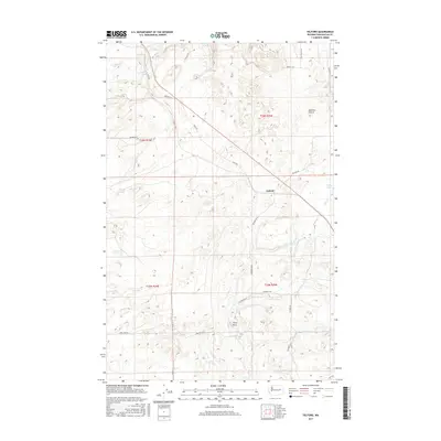
2017 Map of Telford
USGS Topo · Published 2017About this map
Telford occupies the center of this Lincoln County landscape, a region defined by a scattering of small water bodies and seasonal drainages. The topography is shaped by unique geological features like Bachelor Prairie and the distinctive landmark of Tracy Rock, which stand out against the surveyed grid of the Public Land Survey System. The area's hydrology is characterized by numerous small lakes, including Ice Lake, Dunning Lake, and Greenwood Lake to the north, while Reed Lake and Hurley Lake sit to the east.
Find a feature on this map
28 named features on this map. Tap any name to fly to it.
Don’t see what you’re looking for? This feature index may not catch every label — zoom into the map to look around manually.
Map Details
Editions of this 2017 Telford Map
This is the sole edition of this map. No revisions or reprints were ever made.
Other maps of this area

1948 · Wilbur
USGS Topo · 1:62,500

1948 · Lincoln
USGS Topo · 1:62,500

1950 · Lincoln
USGS Topo · 1:62,500

1950 · Wilbur
USGS Topo · 1:62,500

1953 · Ritzville
USGS Topo · 1:250,000

1959 · Ritzville
USGS Topo · 1:250,000

1965 · Ritzville
USGS Topo · 1:250,000

1969 · Rocklyn SW
USGS Topo · 1:24,000

1969 · Telford
USGS Topo · 1:24,000

1969 · Rocklyn
USGS Topo · 1:24,000