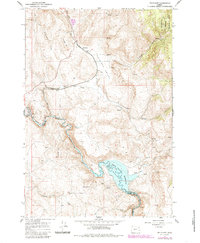
1965 Map of Telocaset
USGS Topo · Published 1985About this map
Telocaset sits as a central junction along the Union Pacific line in this mid-1960s survey of eastern Oregon's high country. The landscape is defined by the significant hydrological engineering of the Powder River, where the Thief Valley Dam holds the Thief Valley Reservoir at the border of Union and Baker counties. This infrastructure supports the agricultural and transit needs of Antelope Valley, a region characterized by numerous water sources such as Foley Spring and Glass Spring.
Find a feature on this map
41 named features on this map. Tap any name to fly to it.
Don’t see what you’re looking for? This feature index may not catch every label — zoom into the map to look around manually.
Map Details
Editions of this 1965 Telocaset Map
2 editions found
Other maps of this area

1901 · Baker City
USGS Topo · 1:125,000

1906 · Telocaset
USGS Topo · 1:125,000

1955 · Baker
USGS Topo · 1:250,000

1955 · Grangeville
USGS Topo · 1:250,000

1959 · Baker
USGS Topo · 1:250,000

1959 · Grangeville
USGS Topo · 1:250,000

1965 · Union
USGS Topo · 1:24,000

1965 · Medical Springs
USGS Topo · 1:24,000
1965 · North Powder
USGS Topo · 1:24,000

1965 · Little Catherine Creek
USGS Topo · 1:24,000