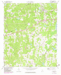
1973 Map of Temple
USGS Topo · Published 1983About this map
The Southern Railway corridor anchors this western Georgia landscape, passing through the growing towns of Temple and Bremen during the early 1970s. The terrain is defined by the headwaters of the Little Tallapoosa River, which feeds into the larger Little Tallapoosa Lake in the east. Local history is deeply embedded in the rural road network, where names like Center Point Road and Hogliver Road connect scattered community centers such as Abilene and Hickory Level. A significant number of country churches and school sites, including Miller Academy and Little Vine Ch, indicate a well-established social fabric in the rural areas surrounding the municipal centers. Industrial development and infrastructure are visible through the network of pipelines and facilities like the Sewage Disposal Pond and Substation, marking the transition from a purely agricultural region to one supporting broader regional utilities.
Find a feature on this map
60 named features on this map. Tap any name to fly to it.
Don’t see what you’re looking for? This feature index may not catch every label — zoom into the map to look around manually.
Map Details
Editions of this 1973 Temple Map
2 editions found
Other maps of this area

1889 · Tallapoosa
USGS Topo · 1:125,000

1891 · Marietta
USGS Topo · 1:125,000

1892 · Tallapoosa
USGS Topo · 1:125,000

1895 · Marietta
USGS Topo · 1:125,000

1897 · Marietta
USGS Topo · 1:125,000

1897 · Tallapoosa
USGS Topo · 1:125,000

1901 · Marietta
USGS Topo · 1:125,000

1953 · Atlanta
USGS Topo · 1:250,000

1957 · Atlanta
USGS Topo · 1:250,000

1958 · Atlanta
USGS Topo · 1:250,000