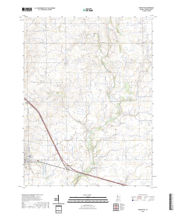
2022 Map of Templeton
USGS Topo · Published 2022About this map
Big Pine Creek and its network of tributaries, including Darby Ditch and Brumm Ditch, carve through the agricultural landscape of Benton County. The settlement of Oxford serves as a primary local center, featuring a grid of streets such as N Michigan St and N Dan Patch Dr. To the southeast, the village of Templeton sits at a critical junction where the modern roadway parallels Old US Hwy 52, marking the historical path of travel through this part of Indiana.
Find a feature on this map
34 named features on this map. Tap any name to fly to it.
Don’t see what you’re looking for? This feature index may not catch every label — zoom into the map to look around manually.
Map Details
Editions of this 2022 Templeton Map
This is the sole edition of this map. No revisions or reprints were ever made.
Other maps of this area

1942 · Otterbein
USGS Topo · 1:24,000

1951 · Otterbein
USGS Topo · 1:24,000

1953 · Danville
USGS Topo · 1:250,000

1955 · Danville
USGS Topo · 1:250,000

1956 · Danville
USGS Topo · 1:250,000

1961 · Chatterton
USGS Topo · 1:24,000

1961 · Pine Village
USGS Topo · 1:24,000

1961 · Otterbein
USGS Topo · 1:24,000

1962 · Mount Gilboa
USGS Topo · 1:24,000
1962 · Round Grove
USGS Topo · 1:24,000