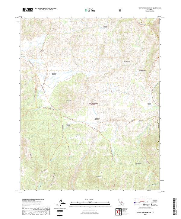
2021 Map of Templeton Mountain
USGS Topo · Published 2021About this map
The Kern Wild And Scenic River flows through the heart of this high-elevation landscape within the Inyo National Forest. This section of the southern Sierra Nevada is defined by a series of high meadows and expansive ranges, including the Toowa Range and Kingfisher Ridge. The map documents a complex network of pack trails and migration routes used for generations, such as the Bakeoven Trl and the Redrock To Templeton-Meadow Trl, which connect various grazing lands and seasonal camps.
Find a feature on this map
51 named features on this map. Tap any name to fly to it.
Don’t see what you’re looking for? This feature index may not catch every label — zoom into the map to look around manually.
Map Details
Editions of this 2021 Templeton Mountain Map
This is the sole edition of this map. No revisions or reprints were ever made.
Other maps of this area

1905 · Olancha
USGS Topo · 1:125,000

1907 · Olancha
USGS Topo · 1:125,000

1948 · Fresno
USGS Topo · 1:250,000

1955 · Fresno
USGS Topo · 1:250,000

1956 · Fresno
USGS Topo · 1:250,000

1956 · Hockett Peak
USGS Topo · 1:62,500
1956 · Monache Mtn
USGS Topo · 1:62,500

1956 · Olancha
USGS Topo · 1:62,500
1956 · Kern Peak
USGS Topo · 1:62,500

1958 · Fresno
USGS Topo · 1:250,000