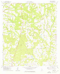
1974 Map of Tempy
USGS Topo · Published 1976About this map
Warrior Creek and Horse Creek carve a dendritic drainage pattern across this section of Worth County, defining a landscape of agriculture and timber production in the mid-1970s. The small settlement of Tempy serves as a central point, surrounded by family-named landmarks and rural infrastructure including the Willis Cemetery and Thornhill Cemetery. The presence of the Oak Grove Ch Sandpit indicates local extractive industry, while the Georgia Northern railroad provides a vital transportation corridor through the western portion of the quadrangle.
Find a feature on this map
21 named features on this map. Tap any name to fly to it.
Don’t see what you’re looking for? This feature index may not catch every label — zoom into the map to look around manually.
Map Details
Editions of this 1974 Tempy Map
2 editions found
Other maps of this area

1953 · Waycross
USGS Topo · 1:250,000

1956 · Sylvester
USGS Topo · 1:62,500

1956 · Doerun
USGS Topo · 1:62,500

1958 · Waycross
USGS Topo · 1:250,000

1973 · Sumner
USGS Topo · 1:24,000

1973 · Ty Ty
USGS Topo · 1:24,000

1973 · Norman Park
USGS Topo · 1:24,000
1973 · Acree
USGS Topo · 1:24,000

1973 · Sylvester
USGS Topo · 1:24,000
1974 · Doerun
USGS Topo · 1:24,000