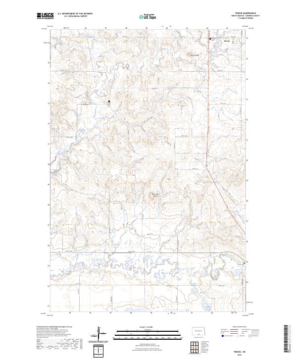
2024 Map of Temvik
USGS Topo · Published 2024About this map
Temvik sits at the northern edge of this Emmons County landscape, a community defined by its proximity to several high points and drainage systems. The terrain is marked by prominent elevations such as Temvik Butte and Winchester Butte, which rise above a network of waterways including Sand Creek, Spring Creek, and Beaver Creek. The southern portion of the survey is notably wetter, featuring the Heidrich Slough and extensive wetland areas. For those tracing family histories in the area, the map precisely locates the Temvik Cem, Sand Creek Cem, and Linton Cem, providing essential coordinates for genealogical research. The rigid grid of section lines and gravel roads like 72nd St SE and Temvik Rd illustrates the enduring layout of North Dakota's agricultural heartland, where these small settlements and burial grounds remain as vital landmarks.
Find a feature on this map
25 named features on this map. Tap any name to fly to it.
Don’t see what you’re looking for? This feature index may not catch every label — zoom into the map to look around manually.
Map Details
Editions of this 2024 Temvik Map
This is the sole edition of this map. No revisions or reprints were ever made.
Other maps of this area

1954 · Bismarck
USGS Topo · 1:250,000

1958 · Bismarck
USGS Topo · 1:250,000

1971 · Grassna NW
USGS Topo · 1:24,000

1971 · Hazelton
USGS Topo · 1:24,000

1971 · Hazelton SW
USGS Topo · 1:24,000

1971 · Grassna NE
USGS Topo · 1:24,000
1971 · Hazelton NW
USGS Topo · 1:24,000

1971 · Strasburg
USGS Topo · 1:24,000

1971 · Temvik
USGS Topo · 1:24,000

1975 · Appert Lake
USGS Topo · 1:24,000