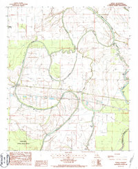
1986 Map of Tendal
USGS Topo · Published 1987About this map
The winding Tensas River and its complex network of oxbow lakes and backwaters define this portion of Madison Parish. The settlement of Tendal sits along the Mo Pac RR, which serves as a primary east-west transport corridor through the alluvial landscape. Nearby, the community of Quebec is positioned near a sharp bend in the river, adjacent to an elevated ditch and several landing strips that reflect the region's agricultural infrastructure.
Find a feature on this map
28 named features on this map. Tap any name to fly to it.
Don’t see what you’re looking for? This feature index may not catch every label — zoom into the map to look around manually.
Map Details
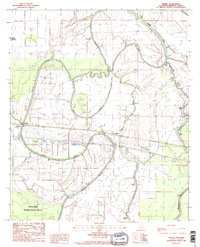
Editions of this 1986 Tendal Map
2 editions found
Other maps of this area

1909 · Tallulah
USGS Topo · 1:24,000

1935 · Waverly
USGS Topo · 1:62,500

1939 · Talla Bena
USGS Topo · 1:62,500

1939 · Alsatia
USGS Topo · 1:62,500

1955 · Jackson
USGS Topo · 1:250,000

1959 · Mitchiner
USGS Topo · 1:62,500

1961 · Jackson
USGS Topo · 1:250,000

1961 · Waverly
USGS Topo · 1:62,500

1962 · Jackson
USGS Topo · 1:250,000
1963 · Fortune Fork
USGS Topo · 1:24,000