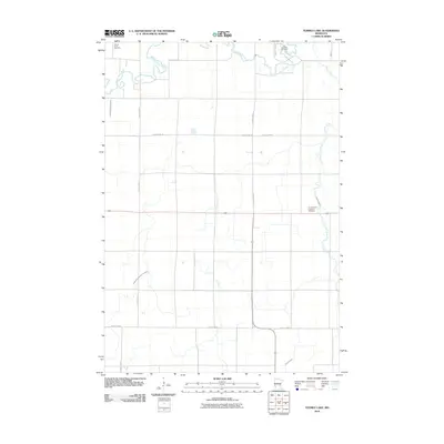
2010 Map of Tenmile Lake
USGS Topo · Published 2010About this map
Lac qui Parle River meanders across the northern portion of this Lac qui Parle County landscape, defining a rural territory managed by an extensive grid of irrigation and drainage works. The presence of County Ditch Number Four and County Ditch Number Thirtyfour reflects the precision of modern agricultural water management in western Minnesota. This terrain is marked by quiet markers of local heritage, most notably the Lac qui Parle Cemetery in the north and Our Saviour's Lutheran Cemetery further south near Tenmile Creek. The map documents a strictly organized transportation network, where County Hwy-27 and County Hwy-58 facilitate travel through the productive agricultural tracts that dominate the quadrangle.
Find a feature on this map
13 named features on this map. Tap any name to fly to it.
Don’t see what you’re looking for? This feature index may not catch every label — zoom into the map to look around manually.
Map Details
Editions of this 2010 Tenmile Lake Map
This is the sole edition of this map. No revisions or reprints were ever made.
Other maps of this area

1953 · Milbank
USGS Topo · 1:250,000

1953 · Watertown
USGS Topo · 1:250,000

1953 · New Ulm
USGS Topo · 1:250,000

1953 · Saint Cloud
USGS Topo · 1:250,000

1957 · Saint Cloud
USGS Topo · 1:250,000

1957 · New Ulm
USGS Topo · 1:250,000

1958 · New Ulm
USGS Topo · 1:250,000

1958 · Milbank
USGS Topo · 1:250,000

1958 · Watertown
USGS Topo · 1:250,000

1958 · Saint Cloud
USGS Topo · 1:250,000