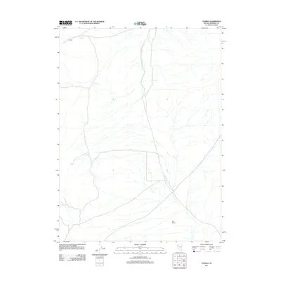
2011 Map of Tenmile
USGS Topo · Published 2011About this map
Antelope Spring and other scattered water sources define the survival of this arid Pershing County landscape. The high desert terrain around Tenmile is marked by a network of unimproved roads and seasonal drainages, reflecting the sparse settlement patterns of rural Nevada in the early twenty-first century. To the southeast, the Twin Buttes rise as prominent landmarks above the alluvial plains. This survey documents the critical water points that historically sustained movement through the region, including Duque Springs and Mud Spring. The vast distances between these features highlight the isolation and the environmental constraints that have shaped the land's utility and history, from ranching routes to modern mineral exploration.
Find a feature on this map
5 named features on this map. Tap any name to fly to it.
Don’t see what you’re looking for? This feature index may not catch every label — zoom into the map to look around manually.
Map Details
Editions of this 2011 Tenmile Map
This is the sole edition of this map. No revisions or reprints were ever made.
Other maps of this area
1886 · Granite Range
USGS Topo · 1:250,000
1894 · Granite Range
USGS Topo · 1:250,000
1955 · Lovelock
USGS Topo · 1:250,000
1959 · Lovelock
USGS Topo · 1:250,000
1964 · Gerlach
USGS Topo · 1:62,500
1964 · Kumiva Peak
USGS Topo · 1:62,500
1980 · Dry Mountain NW
USGS Topo · 1:24,000
1980 · Eagle Rock Spring
USGS Topo · 1:24,000
1980 · Dry Mountain
USGS Topo · 1:24,000
1980 · Tenmile
USGS Topo · 1:24,000