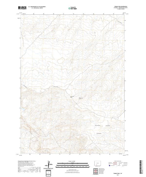
2021 Map of Tenmile Rim
USGS Topo · Published 2021About this map
The Continental Divide traverses this high-desert landscape in Sweetwater County, marking a fundamental hydrologic boundary in the American West. The terrain is characterized by dramatic elevation shifts and drainage systems that define the local geography, notably including the Tenmile Rim and the corresponding Tenmile Draw. These features, along with the nearby Twelvemile Gulch and Ninemile Wash, illustrate the erosional patterns of this arid environment as documented by the U.S. Geological Survey in 2021. The few signs of human infrastructure are concentrated along the winding path of Bitter Creek Rd, which serves as the primary corridor through this open country. This survey provides a precise look at the township and range divisions, including t22n r100w, at a point in time before modern expansion might further alter the traditional land use of the Wyoming interior.
Find a feature on this map
10 named features on this map. Tap any name to fly to it.
Don’t see what you’re looking for? This feature index may not catch every label — zoom into the map to look around manually.
Map Details
Editions of this 2021 Tenmile Rim Map
This is the sole edition of this map. No revisions or reprints were ever made.
Other maps of this area

1954 · Rock Springs
USGS Topo · 1:250,000

1958 · Rock Springs
USGS Topo · 1:250,000

1958 · Twelvemile Well
USGS Topo · 1:62,500

1958 · Superior
USGS Topo · 1:62,500

1962 · Rock Springs
USGS Topo · 1:250,000

1968 · Bitter Creek NW
USGS Topo · 1:24,000

1968 · Point Of Rocks
USGS Topo · 1:24,000

1968 · Bitter Creek NE
USGS Topo · 1:24,000
1980 · Red Desert Basin
USGS Topo · 1:100,000
1986 · Black Rock Flat East
USGS Topo · 1:24,000