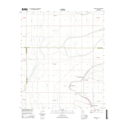
2015 Map of Tensas Bluff
USGS Topo · Published 2015About this map
The Tensas River meanders across this alluvial landscape, defining the boundaries and agricultural rhythms of the region. This 2015 survey reveals a complex hydrological network where the main channel is flanked by former courses and oxbow remnants like the Fool River and Snake Bayou. The settlement pattern is largely tied to the high ground, notably at Tensas Bluff and the nearby New Quarters. These areas, along with river access points such as Tensas Bluff Landing and Hopewell Landing, highlight the historical importance of the river for transport and commerce.
Find a feature on this map
38 named features on this map. Tap any name to fly to it.
Don’t see what you’re looking for? This feature index may not catch every label — zoom into the map to look around manually.
Map Details
Editions of this 2015 Tensas Bluff Map
This is the sole edition of this map. No revisions or reprints were ever made.
Other maps of this area

1935 · Winnsboro
USGS Topo · 1:62,500

1935 · Baskinton
USGS Topo · 1:62,500

1935 · Waverly
USGS Topo · 1:62,500

1935 · Shackleford Lake
USGS Topo · 1:62,500

1955 · Jackson
USGS Topo · 1:250,000

1958 · Baskinton
USGS Topo · 1:62,500

1958 · Shackleford Lake
USGS Topo · 1:62,500

1958 · Winnsboro
USGS Topo · 1:62,500

1961 · Jackson
USGS Topo · 1:250,000

1961 · Waverly
USGS Topo · 1:62,500