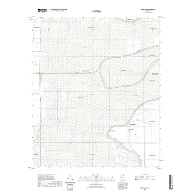
2020 Map of Tensas Bluff
USGS Topo · Published 2020About this map
Tensas River meanders through this low-lying landscape, defining the boundaries and drainage patterns of the eastern Louisiana delta. The area is characterized by a complex network of waterways, including the distinctively named Fool River and Buckshot Bayou, which snake through the alluvial plain. Human settlement is concentrated at Tensas Bluff and the nearby New Quarters, situated among the numerous sloughs and seasonal lakes. Genealogists and local historians may find value in the location of Jordan Cem, tucked away off Parish Rd 107. The map illustrates a remote terrain where water dominates the geography, seen in the winding courses of Snake Bayou and Leading Bayou alongside larger bodies like Big Lake. This modern survey provides an essential look at the contemporary hydrology and rural infrastructure within Tensas Parish and its borders with Madison and Franklin parishes.
Find a feature on this map
33 named features on this map. Tap any name to fly to it.
Don’t see what you’re looking for? This feature index may not catch every label — zoom into the map to look around manually.
Map Details
Editions of this 2020 Tensas Bluff Map
This is the sole edition of this map. No revisions or reprints were ever made.
Other maps of this area

1935 · Winnsboro
USGS Topo · 1:62,500

1935 · Baskinton
USGS Topo · 1:62,500

1935 · Waverly
USGS Topo · 1:62,500

1935 · Shackleford Lake
USGS Topo · 1:62,500

1955 · Jackson
USGS Topo · 1:250,000

1958 · Baskinton
USGS Topo · 1:62,500

1958 · Shackleford Lake
USGS Topo · 1:62,500

1958 · Winnsboro
USGS Topo · 1:62,500

1961 · Jackson
USGS Topo · 1:250,000

1961 · Waverly
USGS Topo · 1:62,500