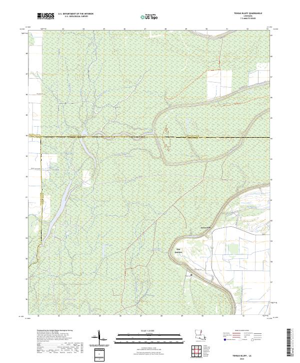
2024 Map of Tensas Bluff
USGS Topo · Published 2024About this map
Tensas River National Wildlife Refuge dominates this section of northeast Louisiana, where the dense hydrology of the Mississippi Delta remains clearly defined. The winding path of the Tensas River serves as a primary geographical anchor, flanked by a complex network of seasonal watercourses and wetlands including Snake Bayou, Jordan Bayou, and Bengal Slough. This landscape is a mosaic of bottomland habitats, punctuated by open water features like Little Lake and Trusler Lake.
Find a feature on this map
35 named features on this map. Tap any name to fly to it.
Don’t see what you’re looking for? This feature index may not catch every label — zoom into the map to look around manually.
Map Details
Editions of this 2024 Tensas Bluff Map
This is the sole edition of this map. No revisions or reprints were ever made.
Other maps of this area

1935 · Winnsboro
USGS Topo · 1:62,500

1935 · Baskinton
USGS Topo · 1:62,500

1935 · Waverly
USGS Topo · 1:62,500

1935 · Shackleford Lake
USGS Topo · 1:62,500

1955 · Jackson
USGS Topo · 1:250,000

1958 · Baskinton
USGS Topo · 1:62,500

1958 · Shackleford Lake
USGS Topo · 1:62,500

1958 · Winnsboro
USGS Topo · 1:62,500

1961 · Jackson
USGS Topo · 1:250,000

1961 · Waverly
USGS Topo · 1:62,500