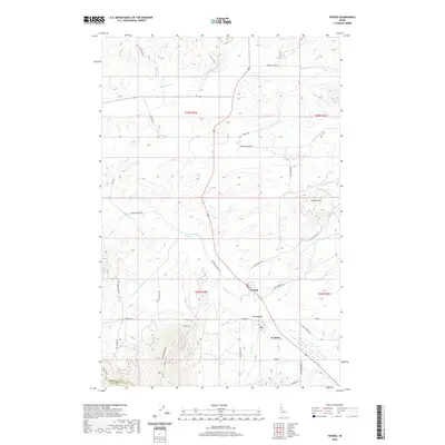
2020 Map of Tensed
USGS Topo · Published 2020About this map
Tensed and De Smet anchor this rural landscape in the southwestern corner of Benewah County, Idaho. The topography is defined by the transition from the fertile reaches of King Valley to the elevated terrain of Lukwle' Mtn and the Latah County line. The hydrology of the region is centered on the westward-flowing Hangman Cr and its tributaries, including Mission Cr and Andrews Spring Cr, alongside the distinctively named Ts'ts'p'qhw'lus Spring. A complex network of local roads such as Old Tensed Rd and Mail Route Rd suggests a long history of agricultural connectivity and settlement. For those tracing the movement of early residents, the Iron Mtn Trail and the placement of the railroad corridor provide significant context for the development of these small inland communities.
Find a feature on this map
38 named features on this map. Tap any name to fly to it.
Don’t see what you’re looking for? This feature index may not catch every label — zoom into the map to look around manually.
Map Details
Editions of this 2020 Tensed Map
This is the sole edition of this map. No revisions or reprints were ever made.
Other maps of this area

1903 · Oakesdale
USGS Topo · 1:125,000

1905 · Oakesdale
USGS Topo · 1:125,000

1954 · Fairfield
USGS Topo · 1:62,500

1955 · Spokane
USGS Topo · 1:250,000

1957 · Plummer
USGS Topo · 1:62,500

1957 · Tensed
USGS Topo · 1:62,500

1958 · Spokane
USGS Topo · 1:250,000

1964 · Tekoa
USGS Topo · 1:24,000
1964 · Farmington
USGS Topo · 1:24,000

1975 · Plummer SE
USGS Topo · 1:24,000