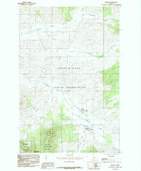
1985 Map of Tensed
USGS Topo · Published 1985About this map
Tensed and De Smet anchor this mid-1980s landscape within the Coeur D'Alene Indian Reservation in northern Idaho. The topography is defined by the transition from the rolling agricultural lands of the Palouse into the rising timbered ridges of the Mary Minerva Mc Croskey Memorial State Park along the southern border at the Benewah Co Latah Co line. Significant watercourses including Hangman Creek, Lolo Creek, and Moctileme Creek drain the terrain, which is characterized by a mix of canyon-cut creek beds and high-elevation elevators that hint at the region's grain-production heritage.
Find a feature on this map
18 named features on this map. Tap any name to fly to it.
Don’t see what you’re looking for? This feature index may not catch every label — zoom into the map to look around manually.
Map Details
Editions of this 1985 Tensed Map
This is the sole edition of this map. No revisions or reprints were ever made.
Other maps of this area

1903 · Oakesdale
USGS Topo · 1:125,000

1905 · Oakesdale
USGS Topo · 1:125,000

1954 · Fairfield
USGS Topo · 1:62,500

1955 · Spokane
USGS Topo · 1:250,000

1957 · Plummer
USGS Topo · 1:62,500

1957 · Tensed
USGS Topo · 1:62,500

1958 · Spokane
USGS Topo · 1:250,000

1964 · Tekoa
USGS Topo · 1:24,000
1964 · Farmington
USGS Topo · 1:24,000

1975 · Plummer SE
USGS Topo · 1:24,000