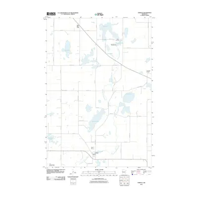
2010 Map of Terrace
USGS Topo · Published 2010About this map
The Terrace settlement anchors this survey, situated at a bend in the East Branch Chippewa River where the Chippewa River Dam regulates the water. This portion of Pope County is defined by a dense network of glacial lakes and wetlands, connected by a grid of rural roads like County Hwy-21 and 195th Ave. For genealogists and local historians, the map identifies the Chippewa Falls Cemetery near the town site and the Immaculate Conception Cemetery to the northeast.
Find a feature on this map
38 named features on this map. Tap any name to fly to it.
Don’t see what you’re looking for? This feature index may not catch every label — zoom into the map to look around manually.
Map Details
Editions of this 2010 Terrace Map
This is the sole edition of this map. No revisions or reprints were ever made.
Other maps of this area

1953 · Saint Cloud
USGS Topo · 1:250,000

1957 · Saint Cloud
USGS Topo · 1:250,000

1958 · Saint Cloud
USGS Topo · 1:250,000

1965 · Westport
USGS Topo · 1:24,000

1965 · Sedan
USGS Topo · 1:24,000

1967 · Lake Johanna
USGS Topo · 1:24,000

1968 · Glenwood
USGS Topo · 1:24,000

1968 · Terrace
USGS Topo · 1:24,000
1968 · Villard
USGS Topo · 1:24,000

1968 · Lake Simon
USGS Topo · 1:24,000