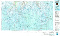
1983 Map of Terrebonne Bay
USGS Topo · Published 1983About this map
The complex amphibious landscape of Louisiana's Gulf Coast is meticulously detailed in this survey, showcasing a region defined by its shifting relationship between land and water. This area is dominated by an intricate network of waterways such as Terrebonne Bay and Timbalier Bay, protected from the open Gulf by a chain of barrier islands including Isles Dernieres and Timbalier Island. The map records the infrastructure of the energy industry, with numerous sites like the Golden Meadow Oil and Gas Field and Bully Camp Oil and Gas Field interspersed among the marshes.
Find a feature on this map
147 named features on this map. Tap any name to fly to it.
Don’t see what you’re looking for? This feature index may not catch every label — zoom into the map to look around manually.
Map Details
Editions of this 1983 Terrebonne Bay Map
This is the sole edition of this map. No revisions or reprints were ever made.
Other maps of this area

1891 · Pointe a La Hache
USGS Topo · 1:62,500

1892 · Barataria
USGS Topo · 1:62,500

1892 · Cheniere Caminada
USGS Topo · 1:62,500

1892 · Gibson
USGS Topo · 1:62,500

1892 · Cut-Off
USGS Topo · 1:62,500

1892 · Houma
USGS Topo · 1:62,500

1892 · Creole
USGS Topo · 1:62,500

1892 · Pointe a La Hache
USGS Topo · 1:62,500

1893 · Fort Livingston
USGS Topo · 1:62,500

1894 · Timbalier
USGS Topo · 1:62,500