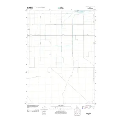
2010 Map of Terreton
USGS Topo · Published 2010About this map
Terreton and the adjacent settlement of Mud Lake anchor this agricultural landscape in Jefferson County. The region's geography is defined by a sophisticated irrigation network essential for high-desert farming, featuring the Owsley Canal, Second Owsley Canal, and Crystal Lake Canal. These man-made waterways crisscross a rigid grid of section roads like Peterson Rd and Twitchell Rd, illustrating the human effort required to manage water in eastern Idaho. To the north, the Mud Lake Dam regulates the water levels of the namesake lake, while the Mud Lake Airport provides a critical transportation link for this rural community. The map reveals a land divided into precise agricultural blocks, where every road name, such as Sidgoway Rd or Canal Rd, reflects the local history of land ownership and the functional necessity of the canal system.
Find a feature on this map
23 named features on this map. Tap any name to fly to it.
Don’t see what you’re looking for? This feature index may not catch every label — zoom into the map to look around manually.
Map Details
Editions of this 2010 Terreton Map
This is the sole edition of this map. No revisions or reprints were ever made.
Other maps of this area

1955 · Idaho Falls
USGS Topo · 1:250,000

1958 · Idaho Falls
USGS Topo · 1:250,000

1964 · Kettle Butte NE
USGS Topo · 1:24,000

1964 · Kettle Butte NW
USGS Topo · 1:24,000

1964 · Terreton
USGS Topo · 1:24,000

1964 · Mud Lake SE
USGS Topo · 1:24,000

1964 · Mud Lake NW
USGS Topo · 1:24,000

1964 · Rays Lake
USGS Topo · 1:24,000

1969 · Antelope Butte
USGS Topo · 1:24,000
1969 · Monteview
USGS Topo · 1:24,000