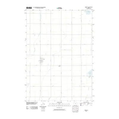
2010 Map of Terril
USGS Topo · Published 2010About this map
Terril serves as the primary hub of this Dickinson County agricultural landscape, organized around a traditional Midwestern grid. The town's infrastructure is clearly defined, featuring the Terril Post Office and a street network including N Schooley St and S Schooley St. South of the town center, Fairview Cemetery sits along 240th St, providing a primary point of interest for genealogists and local historians.
Find a feature on this map
26 named features on this map. Tap any name to fly to it.
Don’t see what you’re looking for? This feature index may not catch every label — zoom into the map to look around manually.
Map Details
Editions of this 2010 Terril Map
This is the sole edition of this map. No revisions or reprints were ever made.
Other maps of this area

1954 · Fairmont
USGS Topo · 1:250,000

1958 · Fairmont
USGS Topo · 1:250,000

1966 · Dickens
USGS Topo · 1:24,000

1970 · Spirit Lake SE
USGS Topo · 1:24,000

1970 · Spirit Lake
USGS Topo · 1:24,000

1972 · Graettinger West
USGS Topo · 1:24,000

1972 · Terril
USGS Topo · 1:24,000

1972 · Wallingford
USGS Topo · 1:24,000

1972 · Estherville
USGS Topo · 1:24,000
1972 · Ruthven
USGS Topo · 1:24,000