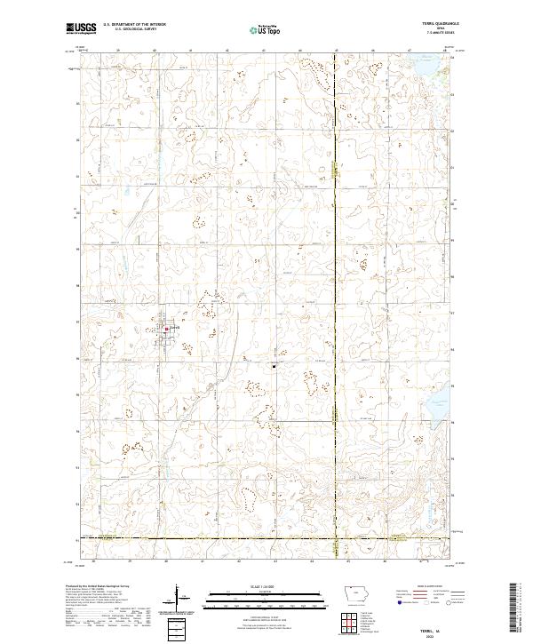
2022 Map of Terril
USGS Topo · Published 2022About this map
Terril serves as the central hub of this agricultural landscape in eastern Dickinson County, positioned near the intersection of Co Rd N14 and Ross Ave. The township structure is defined by a rigorous grid of section lines and drainage features designed for prairie farming, including Big Muddy Cr and the engineered Ditch Number 61. To the east and northeast, the natural hydrology of the region is evident in the presence of Cheever Lake and Twelvemile Lake, which break the geometric pattern of the surrounding fields. Local history is anchored by the Fairview Cem located south of the main settlement along 240th St. This area reflects the late twentieth-century development of northwestern Iowa's rural road networks and water management systems, stretching to the borders of Emmet, Clay, and Palo Alto counties.
Find a feature on this map
47 named features on this map. Tap any name to fly to it.
Don’t see what you’re looking for? This feature index may not catch every label — zoom into the map to look around manually.
Map Details
Editions of this 2022 Terril Map
This is the sole edition of this map. No revisions or reprints were ever made.
Other maps of this area

1954 · Fairmont
USGS Topo · 1:250,000

1958 · Fairmont
USGS Topo · 1:250,000

1966 · Dickens
USGS Topo · 1:24,000

1970 · Spirit Lake SE
USGS Topo · 1:24,000

1970 · Spirit Lake
USGS Topo · 1:24,000

1972 · Graettinger West
USGS Topo · 1:24,000

1972 · Terril
USGS Topo · 1:24,000

1972 · Wallingford
USGS Topo · 1:24,000

1972 · Estherville
USGS Topo · 1:24,000
1972 · Ruthven
USGS Topo · 1:24,000