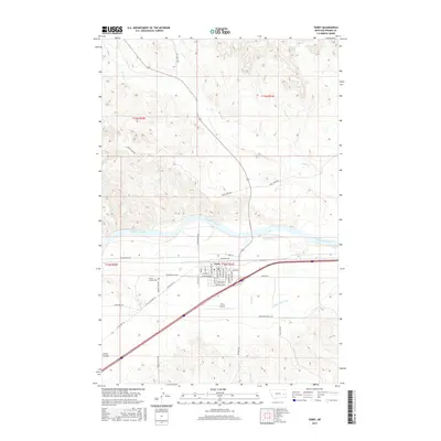
2017 Map of Terry
USGS Topo · Published 2017About this map
The Yellowstone River serves as the central artery for this landscape, dividing the high plateaus of Broadview Bench from the northern breaks. The town of Terry sits south of the river, defined by a grid that includes Montana Blvd and Milwaukee St, which trace the path of historic transportation routes across the prairie. The surrounding geography is defined by a dense network of seasonal drainages such as Coal Cr and Cherry Cr that carve through the local terrain toward the river valley.
Find a feature on this map
50 named features on this map. Tap any name to fly to it.
Don’t see what you’re looking for? This feature index may not catch every label — zoom into the map to look around manually.
Map Details
Editions of this 2017 Terry Map
This is the sole edition of this map. No revisions or reprints were ever made.
Other maps of this area

1953 · Miles City
USGS Topo · 1:250,000

1957 · Miles City
USGS Topo · 1:250,000

1958 · Miles City
USGS Topo · 1:250,000

1969 · Zero NE
USGS Topo · 1:24,000

1969 · Zero
USGS Topo · 1:24,000

1969 · Flat Top Butte
USGS Topo · 1:24,000

1972 · Hendrickson Coulee
USGS Topo · 1:24,000

1972 · Calypso
USGS Topo · 1:24,000

1972 · Papps Reservoir
USGS Topo · 1:24,000

1972 · Diamond G Creek
USGS Topo · 1:24,000