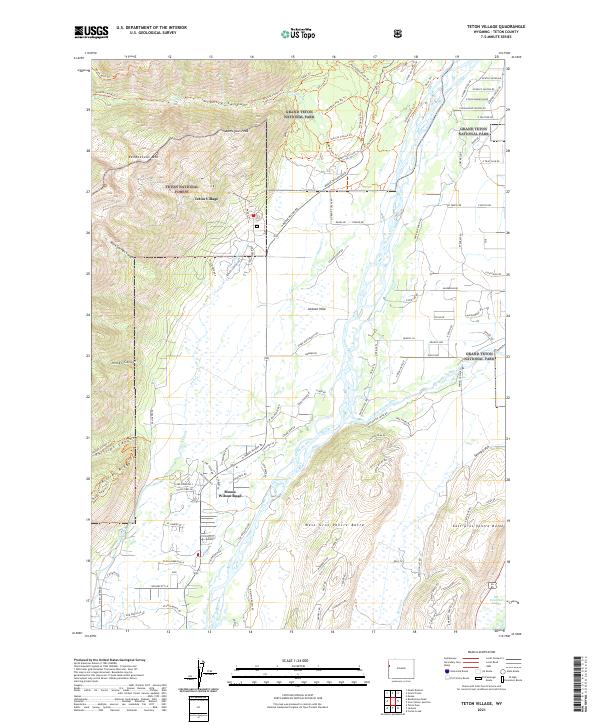
2021 Map of Teton Village
USGS Topo · Published 2021About this map
Teton Village serves as a gateway to the high-elevation wilderness of the Teton National Forest and Grand Teton National Park, where the steep eastern front of the range meets the valley floor. High points like Rendezvous Mtn and Apres Vous Peak tower over canyons such as Granite Canyon and Rock Springs Canyon, while the braided channels of the Snake River dominate the lowlands. The map details the transition from alpine trails, including the Valley Trl and Granite Canyon Trl, to the structured roads of Jackson Hole. Along the southern reach, the Gros Ventre River flows between West Gros Ventre Butte and East Gros Ventre Butte, leading toward the National Elk Refuge and its Elk Exhibition Pasture, illustrating the valley's role as a vital corridor for both wildlife and recreation.
Find a feature on this map
120 named features on this map. Tap any name to fly to it.
Don’t see what you’re looking for? This feature index may not catch every label — zoom into the map to look around manually.
Map Details
Editions of this 2021 Teton Village Map
This is the sole edition of this map. No revisions or reprints were ever made.
Other maps of this area

1899 · Grand Teton
USGS Topo · 1:125,000

1901 · Grand Teton
USGS Topo · 1:125,000

1931 · Jackson
USGS Topo · 1:125,000

1935 · Jackson
USGS Topo · 1:125,000

1955 · Driggs
USGS Topo · 1:250,000

1958 · Driggs
USGS Topo · 1:250,000

1962 · Driggs
USGS Topo · 1:250,000

1963 · Jackson
USGS Topo · 1:24,000

1963 · Teton Pass
USGS Topo · 1:24,000
1965 · Cache Creek
USGS Topo · 1:24,000