
1953 Map of Texarkana
USGS Topo · Published 1964About this map
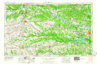
The Red River winds through the borderlands of Texas, Oklahoma, and Arkansas, defining a landscape of dense river bottoms and rising upland prairies. In the years following World War II, this region became a critical corridor for military and industrial operations, anchored by the Red River Arsenal and the Lone Star Ordnance Plant west of Texarkana. The map captures a moment of transition for the land, noting the Camp Maxey Military Reservation (Abandoned) north of Paris, while the creation of Lake Texarkana on the Sulphur River reshaped the local topography. This period saw a complex network of railroads like the Texas and Pacific and St Louis Southwestern supporting local commerce in towns such as Clarksville, Mount Pleasant, and New Boston, alongside numerous rural landmarks including Old Boston Cem and College Hill Sch.
Find a feature on this map
92 named features on this map. Tap any name to fly to it.
Don’t see what you’re looking for? This feature index may not catch every label — zoom into the map to look around manually.
Map Details
Editions of this 1953 Texarkana Map
4 editions found
Other maps of this area

1899 · Atoka
USGS Topo · 1:125,000

1900 · Atoka
USGS Topo · 1:125,000

1901 · Antlers
USGS Topo · 1:125,000

1901 · Alikchi
USGS Topo · 1:125,000

1902 · Lukfata
USGS Topo · 1:125,000

1903 · Paris
USGS Topo · 1:125,000

1906 · Caddo Gap
USGS Topo · 1:125,000

1907 · Atlanta
USGS Topo · 1:62,500

1909 · New Boston
USGS Topo · 1:62,500

1909 · Texarkana
USGS Topo · 1:62,500