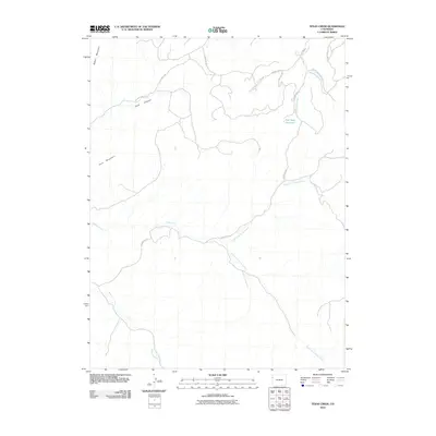
2010 Map of Texas Creek
USGS Topo · Published 2010About this map
Rabbit Mountain and Park Mountain anchor this high-desert landscape in Rio Blanco County, where the intricate drainage network of the Colorado Plateau is meticulously documented. The terrain is defined by the convergence of the North Fork Texas Creek and South Fork Texas Creek, which merge into the main stem of Texas Creek. This hydrology, alongside Missouri Creek and the various branches of Red Wash, illustrates the natural pathways that have dictated movement through this region for generations.
Find a feature on this map
19 named features on this map. Tap any name to fly to it.
Don’t see what you’re looking for? This feature index may not catch every label — zoom into the map to look around manually.
Map Details
Editions of this 2010 Texas Creek Map
This is the sole edition of this map. No revisions or reprints were ever made.
Other maps of this area

1885 · East Tavaputs
USGS Topo · 1:250,000

1956 · Grand Junction
USGS Topo · 1:250,000

1959 · Grand Junction
USGS Topo · 1:250,000

1960 · Grand Junction
USGS Topo · 1:250,000

1962 · Grand Junction
USGS Topo · 1:250,000

1964 · Grand Junction
USGS Topo · 1:250,000

1964 · Texas Creek
USGS Topo · 1:24,000

1964 · East Evacuation Creek
USGS Topo · 1:24,000
1964 · Water Canyon
USGS Topo · 1:24,000
1964 · Texas Mountain
USGS Topo · 1:24,000