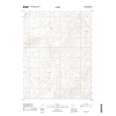
2019 Map of Texas Creek
USGS Topo · Published 2019About this map
Texas Creek and its complex drainage system define this high-country landscape in Rio Blanco County. The map captures a detailed hydrographic network including N Fork Texas Cr, S Fork Texas Cr, and the various branches of the Red Wash, which feed into the Red Wash Reservoir. The terrain is characterized by prominent peaks and deep cuts, such as Park Mtn and Rabbit Mtn, alongside the significant depression of Park Canyon. The network of local routes, including Co RD 109 and Co RD 23, provides access to these high elevations and remote drainage basins, illustrating the infrastructure required to manage water and transit in this part of western Colorado.
Find a feature on this map
21 named features on this map. Tap any name to fly to it.
Don’t see what you’re looking for? This feature index may not catch every label — zoom into the map to look around manually.
Map Details
Editions of this 2019 Texas Creek Map
This is the sole edition of this map. No revisions or reprints were ever made.
Other maps of this area

1885 · East Tavaputs
USGS Topo · 1:250,000

1956 · Grand Junction
USGS Topo · 1:250,000

1959 · Grand Junction
USGS Topo · 1:250,000

1960 · Grand Junction
USGS Topo · 1:250,000

1962 · Grand Junction
USGS Topo · 1:250,000

1964 · Grand Junction
USGS Topo · 1:250,000

1964 · Texas Creek
USGS Topo · 1:24,000

1964 · East Evacuation Creek
USGS Topo · 1:24,000
1964 · Water Canyon
USGS Topo · 1:24,000
1964 · Texas Mountain
USGS Topo · 1:24,000