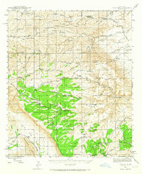
1943 Map of Texas Hill
USGS Topo · Published 1965About this map
The high Chihuahuan desert and the rugged Guadalupe Mountains transition within the Lincoln National Forest, where this 1943 survey documents a landscape defined by ranching and Depression-era public works. Ranching headquarters such as Armstrong & Armstrong Headquarters Ranch and the Hardin Ranch anchor the northern reaches, while the Indian Side Camp (CCC) represents the legacy of the Civilian Conservation Corps in developing the region's infrastructure.
Find a feature on this map
103 named features on this map. Tap any name to fly to it.
Don’t see what you’re looking for? This feature index may not catch every label — zoom into the map to look around manually.
Map Details
Editions of this 1943 Texas Hill Map
2 editions found
Other maps of this area

1935 · El Paso Gap
USGS Topo · 1:62,500

1936 · El Paso Gap
USGS Topo · 1:48,000

1940 · El Paso Gap
USGS Topo · 1:62,500

1940 · Bandanna Point
USGS Topo · 1:62,500

1940 · Carlsbad Caverns West
USGS Topo · 1:62,500

1943 · Carlsbad Caverns West
USGS Topo · 1:62,500

1943 · Bandanna Point
USGS Topo · 1:62,500

1943 · Texas Hill
USGS Topo · 1:62,500

1945 · Texas Hill
USGS Topo · 1:62,500

1954 · Carlsbad
USGS Topo · 1:250,000