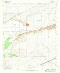
1965 Map of Texas Hill
USGS Topo · Published 1966About this map
The Texas Hill landform rises above the desert floor, anchoring a landscape defined by water management and transit in southwestern Arizona. This mid-1960s survey reveals the complex irrigation system of the Texas Hill Canal as it draws from the Gila River, supporting agricultural development near the Southern Pacific railroad corridor. The presence of the Pumping Sta and various unnamed wells indicates the intensive effort to reclaim this arid region for production.
Find a feature on this map
20 named features on this map. Tap any name to fly to it.
Don’t see what you’re looking for? This feature index may not catch every label — zoom into the map to look around manually.
Map Details
Editions of this 1965 Texas Hill Map
3 editions found
Other maps of this area

1926 · Mohawk
USGS Topo · 1:62,500

1927 · Kim
USGS Topo · 1:62,500

1928 · Mohawk
USGS Topo · 1:62,500

1928 · Norton
USGS Topo · 1:62,500

1929 · Norton
USGS Topo · 1:62,500

1930 · Stoval
USGS Topo · 1:62,500

1931 · Kim
USGS Topo · 1:62,500

1950 · Stoval
USGS Topo · 1:62,500

1953 · Ajo
USGS Topo · 1:250,000

1955 · Growler
USGS Topo · 1:24,000