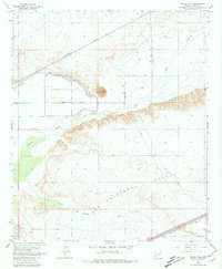
1965 Map of Texas Hill
USGS Topo · Published 1981About this map
Texas Hill rises above the arid lowlands of Yuma County, serving as a prominent landmark in a landscape defined by the erratic course of the Gila River. In the mid-1960s, this desert region relied heavily on water management infrastructure, evidenced by the Texas Hill Canal and numerous wells scattered across the flats. The northern portion of the map is dominated by the Southern Pacific rail line, which supported small sidings like Stoval near the edge of the Luke Air Force Range. South of the river, the vast expanse of the San Cristobal Valley and the San Cristobal Wash illustrate the natural drainage patterns of the Sonoran Desert. Industrial activity is localized but present, with a Gravel Pit and Sandpit indicating the extraction of river-deposited materials to support regional development and the maintenance of the nearby transportation corridor.
Find a feature on this map
14 named features on this map. Tap any name to fly to it.
Don’t see what you’re looking for? This feature index may not catch every label — zoom into the map to look around manually.
Map Details
Editions of this 1965 Texas Hill Map
3 editions found
Other maps of this area

1926 · Mohawk
USGS Topo · 1:62,500

1927 · Kim
USGS Topo · 1:62,500

1928 · Mohawk
USGS Topo · 1:62,500

1928 · Norton
USGS Topo · 1:62,500

1929 · Norton
USGS Topo · 1:62,500

1930 · Stoval
USGS Topo · 1:62,500

1931 · Kim
USGS Topo · 1:62,500

1950 · Stoval
USGS Topo · 1:62,500

1953 · Ajo
USGS Topo · 1:250,000

1955 · Growler
USGS Topo · 1:24,000